


Flight Director – The solution for general aviation aerodromes
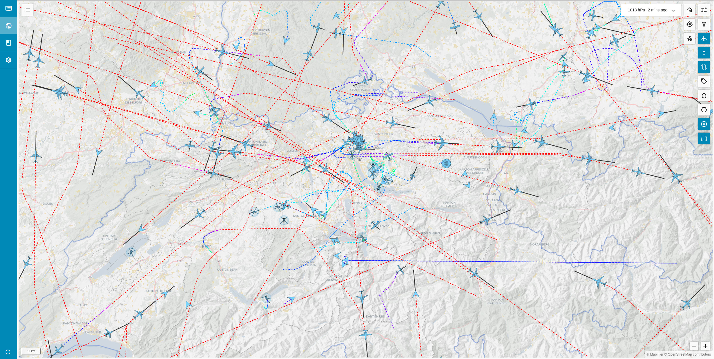
jetvision Flight Director improves visual awareness and simplifies the daily operations of regional and club aerodromes with a comprehensive display and data service. By aggregating ADS-B AND MLAT Mode-S positions from our high-precision sensor network together with FLARM and UAT sources, the MLAT server calculates and provides accurate position tracking of the aircraft. jetvision Flight Director recognises landings, take-offs, touch-and-goes and go-arounds and automatically maintains the aerodrome’s landing and take-off logbook. Manual checking and adjustment of logbook entries is of course possible before the data is transmitted to the billing system.
jetvision MLAT Network
Flight Director is based on jetvision’s MLAT network data service and provides high-precision, low-latency and uninterrupted coverage of aircraft positions. This precision is made possible by a homogeneous fleet of receivers based on jetvision’s proven Beast, Radarcape and Airsquitter RF technologies, enabling precise, time-stamped multilateration for reliable and consistent data – plus the integration of other standards such as FLARM™ or UAT.
With the support of the community and strategically placed receivers, many of which were directly managed, blanket coverage was achieved across central Europe, often reaching as far as ‘treetop coverage’ and even down to the ground at many airfields.
Coverage can be added on demand with minimal infrastructure and capital requirements. jetvision’s cost-effective and modular receiver technology enables easy network expansion, improving local coverage.
Advanced event detection
Flight Director’s intelligent event detection system distinguishes between different types of movement and highlights them visually on both the map and the flight strip display. The strategic addition of several receivers ensures reliable coverage when required.

Takeoff

Touch&Go

Goaround

Landing
Logbook
The logbook view provides a clear record of landing and take-off activities with options to change, add or delete events. Events can be exported as CSV files for further processing and linked to third-party systems, such as aerops Payment Systems™ or others.


Flight Strips
The flight strips show the aircraft in the nearby event area and provide a precise overview of the relevant movements. The ‘Local’, ‘Pattern’, ‘Unclassified’ and ‘Ignore’ buttons can be used to sort the display of the flight strips according to different categories to make it easier to keep track. The flight strips also display important data on the respective aircraft. This allows critical situations to be recognised at an early stage and better managed. The flight strip display can be hidden and shown again as required, allowing even more flexible and efficient management of aircraft movements.
3D KML events
Download the KML files of the detected and logged flight events to analyse them in detail after the flight. These KML files can be opened in applications such as Google Earth, enabling a detailed 3D analysis of the events. In this interactive 3D environment, the locations of the incidents and the respective flight altitudes can be clearly visualised. This option provides deeper insights into the processes and serves as a valuable tool for debriefings or incident analyses. The insights gained make a significant contribution to increasing safety and optimising the efficiency of operational processes.


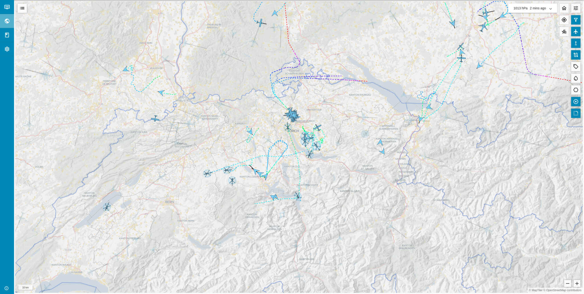
Distance circles
Range circles provide a useful visual aid to accurately determine the distance between an aircraft and the aerodrome. They appear as concentric circles arranged at regular intervals of 5 nautical miles around the airfield, providing a clear and extended overview of the surroundings. This visualisation makes it possible to determine the positions of aircraft and their distances more quickly and efficiently. This increases situational awareness and helps to recognise potential conflicts at an early stage.
Traffic Pattern
The Flight Director supports user-specific local traffic patterns which are added to a customizable layer. These are designed in consultation with the customer during the onboarding process. The visualisation can then be adapted to operational requirements, increasing both safety and efficiency.


Airspace structure
The ICAO Airspace Overlay provides an easy way to view particularly critical airspace elements. It can be used to display different airspace classes, restricted areas and other important zones for which clearance is required. By customising visibility, an operator can gain a clearer understanding of the airspace environment to support safer and more informed decision making – and perhaps even warn a pilot of an impending airspace penetration.
Flight paths
The flight paths function supports the display of the last aircraft positions. The route length can be customised by configuring the duration, making this a valuable tool for understanding flight dynamics and improving operational insight. By adjusting colours and transparency, key elements such as altitude changes over time can be highlighted, providing insights into the altitude profile at specific points in time.


Precipitation radar and QNH support
Weather data from the DWD has been seamlessly integrated to provide a 5-minute display of precipitation in Germany and Europe. QNH values can be entered manually or retrieved from the DWD METAR source for accurate aircraft altitude visualisation.
Map view
Flight Director allows you to easily activate different layers, adjust transparencies and customise the sizes and colours of individual elements. Whether you use preset designs or personalise every detail, the map can be customised to exact specifications. From sleek, dark maps with few labels to detailed views with aircraft icons and comprehensive airspace information, the options are almost completely customisable.


Aircraft filter
The aircraft filter feature provides powerful tools for filtering displayed aircraft according to specific criteria. Whether you are focusing on a specific altitude range, tracking only fast-moving aircraft or excluding ground traffic, this tool provides a customised and optimised visual experience. By removing irrelevant data, clutter on the screen is minimised, allowing you to focus on critical traffic and improve situational awareness.
Local views
A location view preset feature allows you to save and quickly access specific map and display presets tailored to your operational requirements. Whether it is a critical airport, training area or other frequently monitored airspace, views can be saved and instantly recalled at their individual zoom level. This simplifies switching between different areas of interest, reduces time and improves workflow efficiency.


Aircraft symbols
The aircraft symbol library ensures that most aircraft types encountered are displayed with an accurate and recognisable symbol. The symbols are designed for quick identification on the display. The clarity and precision of these symbols reduces cognitive load and enables faster recognition and response in both routine and high-pressure situations.
Flight vectors
Flight vectors provide a visual prediction of an aircraft’s future trajectory based on the assumption of its current heading and speed by extending a line forward from the aircraft. The length and direction of the vector thus provide an immediate insight into the future.


Aircraft labels
Aircraft labels provide a customisable way to display important information next to the position of each aircraft on the screen. The content and position of these labels can be customised to show minimal data or more detailed flight information, depending on preference. Options include basic details such as registration and altitude or advanced data if required. The proximity of the labels to the aircraft icon can also be changed to reduce clutter on the screen and ensure the right information is available at a glance, tailored to the specific needs of the operator.
Simple set-up
Flight Director eliminates the need for software installation by providing a fully browser-based solution that is compatible with Windows, macOS and Linux. Flight Director is instantly accessible from anywhere – whether at home, in the office or on the move. No downloads are required, so the latest features and enhancements are always available directly from the user’s browser. This saves time and ensures that the tools are always up to date and ready when needed.

„ Thanks to jetvision Flight Director, our operations managers recognise incoming air traffic much faster and earlier. The integration of weather data and the flight strip overview has already helped to identify incoming aircraft on several occasions, even long before they were recognisable to the naked eye. “
EDLE Constantin Budny, Flight control coordinator, Essen-Mülheim airfield
„ The Flight Director helps us to recognise the flight situation much more transparently and quickly and thus to keep an overview of airfield traffic and approaching aircraft under control, especially on days with high flight volumes. “
EDFZ Dieter Kohl, Managing Director, Mainz-Finthen airfield
„ With the help of Flight Director, we have already been able to identify and defuse critical flight situations in good time on several occasions. The automatic recognition of take-off and landing manoeuvres in particular helps us to manage the main flight log efficiently and precisely. “
LOAN Harald Ullmann, CEO Diamond SFCA Flugplatzbetriebs GmbH, Wiener Neustadt
Contact us to request a Flight Director demo for your location
Would you like to find out how Flight Director can improve your daily flight operations? Do you need an analysis of the local network coverage for the operation of Flight Director at your aerodrome? Looking for an online presentation? Contact us about your preferred method!


